The mix of LiDAR technology and photogrammetry is changing aerial mapping. New tech, like UAV-based bathymetry (Kujawa et al., 2025), shows how these can work together.
By blending LiDAR and photogrammetry, we get very accurate maps. This new way is making big changes in fields like surveying, building, and watching the environment.
Key Takeaways
- Hybrid LiDAR–Photogrammetry Systems make aerial mapping more accurate.
- Putting LiDAR and photogrammetry together is helping many industries grow.
- UAVs are leading the way in making new things possible in this area.
- We can now make very detailed maps with LiDAR and photogrammetry together.
- The future of aerial mapping looks bright with these new tech steps.
Understanding Hybrid LiDAR–Photogrammetry Systems
LiDAR and photogrammetry together have changed aerial mapping a lot. They make maps very accurate and detailed.
What is Hybrid LiDAR?
Hybrid LiDAR mixes LiDAR tech with other tech to make it better. LiDAR uses laser light to measure distances. It makes 3D models of things and places.
Dietrich (2016) says LiDAR is great for mapping and watching the environment. “Hybrid” means adding other tech, like photogrammetry, to LiDAR. This makes data more accurate and efficient.
Overview of Photogrammetry
Photogrammetry is about getting data from photos. It uses images to make 3D models and maps. Agrafiotis & Demir (2025) talk about how drones with cameras have made aerial mapping better.
The steps are:
- Capture photos of the area from different angles.
- Use special software to find points in common.
- Make a 3D model or map from these points.
Benefits of Combining the Two Technologies
LiDAR and photogrammetry together are very good. They make maps more accurate, efficient, and detailed. They offer:
- Enhanced Accuracy: LiDAR gives exact distances, and photogrammetry adds color and texture.
- Increased Efficiency: Using both techs means fewer trips are needed.
- Comprehensive Data: You get the best of both worlds, precise LiDAR and detailed photogrammetry.
“The fusion of LiDAR and photogrammetry represents a significant step forward in aerial mapping, with unprecedented detail and accuracy.”
LiDAR and photogrammetry together are changing aerial mapping. They make maps more accurate and detailed than ever.
Core Components of Hybrid Systems
To understand Hybrid LiDAR–Photogrammetry, we need to look at its main parts. These systems mix different technologies to make detailed aerial maps.
LiDAR Sensors Explained
LiDAR (Light Detection and Ranging) sensors are key in Hybrid LiDAR–Photogrammetry. They send out laser pulses to the ground. This helps create accurate 3D models of the terrain.
Pfeifer et al. (2012) say LiDAR’s accuracy depends on the sensor, flight height, and how the data is processed.
The table below shows what makes LiDAR sensors special:
| Characteristic | Description | Importance |
|---|---|---|
| Laser Pulse Rate | Rate at which laser pulses are emitted | High pulse rates increase data density |
| Flight Altitude | Height at which the sensor is operated | Affects resolution and accuracy |
| Scan Angle | Angle at which the laser scans the terrain | Influences swath width and data coverage |
Photogrammetry Equipment
Photogrammetry uses high-resolution cameras with LiDAR sensors. Nex & Remondino (2014) say camera quality, lens distortion, and image overlap matter.
Software for Processing Data
Special software is used to process LiDAR and photogrammetry data. It combines both to make detailed 3D models and accurate maps. Important features include making point clouds, stitching images, and integrating data.
Key Software Features:
- Point cloud generation from LiDAR data
- Image stitching and orthorectification
- Integration of LiDAR and photogrammetry data
- Generation of 3D models and DEMs
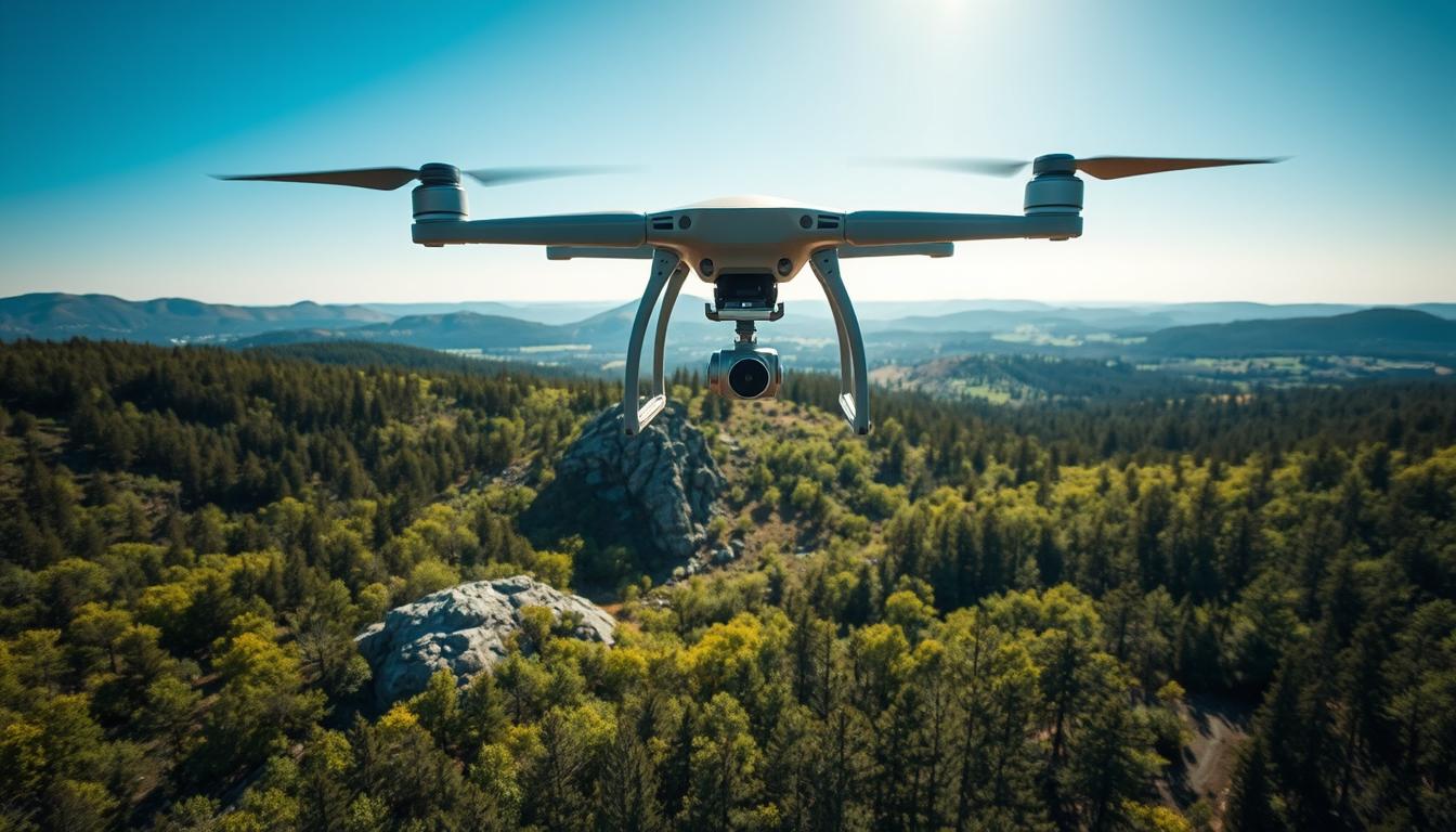
Advantages of Using Drones for Aerial Mapping
Drones have changed aerial mapping a lot. They make it faster and more accurate. They use LiDAR and photogrammetry to collect and use data in many ways.
Enhanced Efficiency
Drones make aerial mapping projects much faster. They can cover big areas quickly and get high-quality data fast. Stolaroff et al. (2018) say drones can cut data collection time by up to 50%.
Efficient data collection is also better because drones can follow a set path. This makes sure they cover the area well. It also makes the data more accurate.
Cost-Effectiveness
Drones are also cheaper to use for aerial mapping. They don’t need manned planes and collect data fast. Frachtenberg (2019) says drone LiDAR surveying is up to 30% cheaper than old methods.
- Less money for fuel and upkeep
- Lower labor costs because data is collected and processed faster
- Low cost for drones, which can carry many sensors and cameras
Greater Accessibility
Drones make aerial mapping easier to do in hard places. They can go where planes can’t and get data in tough spots. This lets us map more places than before.
Drones are a big step forward in aerial mapping. They bring many benefits like being fast, cheap, and easy to use. As drones get better, they’ll be even more important for getting accurate data.
Applications of Hybrid LiDAR–Photogrammetry

Hybrid LiDAR–Photogrammetry has many uses. It helps in city planning and saving the environment. This tech gives us precise and detailed data.
Urban Planning
In city planning, this tech makes detailed maps. These maps help find the best places for new buildings and roads. Research by Kujawa & Remondino (2025) shows LiDAR makes maps more accurate.
It also helps track how cities grow and change. For example, it can see how new buildings affect the area around them.
Environmental Monitoring
Hybrid LiDAR–Photogrammetry is key for watching over the environment. It gives info on land changes, plant health, and water quality. Studies by Torresan et al. (2017) say LiDAR and photogrammetry together make environmental checks better.
This tech is great for watching over special places and spotting early signs of harm. It helps see if saving the environment is working.
Infrastructure Inspection
For checking on buildings and roads, Hybrid LiDAR–Photogrammetry is used. It tells us how well these things are doing. This helps teams fix things without spending too much.
For example, LiDAR can spot small changes in a bridge. This means we can fix problems before they get worse.
The Process of Data Collection
Data collection is very important in aerial mapping. It needs careful planning. We must make sure the data we get is right and trustworthy.
Choosing the Right Drone
Picking the right drone is key. It should have the right sensors, like LiDAR or photogrammetry. Drones made for aerial surveying have great cameras and fly steady, perfect for detailed shots.
Think about how long it can fly, how much it can carry, and the terrain. For big areas, choose a drone that can fly longer.
Flight Planning Tips
Good flight planning is vital. You need to plan the best path, height, and image overlap. Flight planning software helps make a detailed plan, considering the terrain and detail level.
Remember the weather and airspace rules too. Flying in calm, clear weather helps get better data.
Safety Considerations
Safety is always first in aerial surveys. Make sure the drone works well, follow rules, and stay away from people and things. Do pre-flight checks to find any problems before flying.
Having a backup plan is also smart. This could be a spare drone or being ready for weather changes.
Data Processing Techniques
Data processing is key to making hybrid LiDAR–photogrammetry systems work well. It turns raw data into detailed models.
Point Cloud Generation
Creating a point cloud is a big step in LiDAR data processing. It makes a set of data points that show the outside of objects.
“LiDAR point cloud processing has become a key part in many fields, like topographic mapping, forestry, and urban planning”
(Pfeifer et al., 2012). The quality of the point cloud is very important for the model’s accuracy.
To make a point cloud, you need to filter, register, and georeference the data. Advanced algorithms help remove bad data points. This makes the point cloud reliable and accurate.
Image Stitching Basics
Image stitching is a basic part of photogrammetry. It combines many images to make a complete picture of the area. Advanced photogrammetry software aligns and blends the images for a smooth final image.
The quality of the stitched image depends on several things. These include how much the images overlap, the camera’s resolution, and the georeferencing data. Having enough overlap is key for a seamless image.
Integrating LiDAR and Photogrammetry Data
Mixing LiDAR and photogrammetry data is a complex task. It needs special software and algorithms. The goal is to get a very accurate and detailed model. As noted by Nex & Remondino (2014),
“Mixing LiDAR and photogrammetry data makes the final model more accurate and reliable”
| Technique | Description | Benefits |
|---|---|---|
| Point Cloud Generation | Creating a set of data points representing external surfaces | High accuracy, detailed representation |
| Image Stitching | Combining multiple images into a seamless visual representation | Comprehensive coverage, visually appealing |
| Data Integration | Merging LiDAR and photogrammetry data | Improved accuracy, enhanced detail |
Using these techniques, users can get very accurate and detailed models. This unlocks the full power of their aerial mapping projects.
Key Challenges and Considerations
Working with Hybrid LiDAR–Photogrammetry Systems has its challenges. These systems are great for aerial mapping but face some limits. These can affect how well they work.
Weather Dependency
Weather is very important for these systems. Bad weather like rain, fog, or too much sun can mess up data collection. This can make LiDAR and photogrammetry data less accurate.
LiDAR uses laser pulses to measure distances. Weather can change how fast and where these pulses go. This can cause errors in the data.
Data Accuracy Issues
Getting accurate data is a big challenge. LiDAR and photogrammetry data need to be perfectly aligned and calibrated. Any mistakes in this process can lead to big errors.
To fix these problems, we need to use strong data processing and quality checks. This includes using special software for creating point clouds and stitching images together.
Equipment Limitations
Equipment limitations are another big challenge. The quality and what the LiDAR sensors and photogrammetry equipment can do vary a lot. This affects how well the Hybrid LiDAR–Photogrammetry System works.
It’s very important to know these limits. This helps us choose the right equipment for what we need. And makes sure we use the system the way it’s meant to be used.
| Challenge | Description | Mitigation Strategy |
|---|---|---|
| Weather Dependency | Adverse weather conditions affecting data collection | Plan data collection around favorable weather; use weather-resistant equipment |
| Data Accuracy Issues | Inaccuracies due to data misalignment or processing errors | Implement robust data processing and quality control measures |
| Equipment Limitations | Variability in equipment quality and capability | Select appropriate equipment for the application; understand operational capabilities |
Best Practices for Aerial Mapping
To get the best aerial mapping data, follow some key steps. These steps help make sure your flights go well, your gear is right, and you keep everything in top shape. This way, you get accurate and reliable data from your Hybrid LiDAR–Photogrammetry Systems.
Ensuring Optimal Flight Conditions
For a successful aerial mapping mission, you need the right weather and a good flight plan. Here’s what to do:
- Choose the best weather: Stay away from strong winds, heavy rain, or too hot or cold.
- Plan your flight path: Make sure you cover everything with enough overlap.
- Think about the time of day: Fly when the sun is at the best angle for your data.
Calibration of Equipment
Calibration is key for accurate data from Hybrid LiDAR–Photogrammetry Systems. Here’s how to do it right:
- Calibrate your LiDAR sensor: Make sure it measures distances and intensities correctly.
- Calibrate your cameras: They need to be aligned and set up for the best images.
- Check the integration: Make sure LiDAR and photogrammetry data work together well.
Regular Maintenance of Systems
Keeping your Hybrid LiDAR–Photogrammetry Systems in top shape is important. Here’s how:
- Regularly check and clean your sensors and cameras.
- Keep your software up to date.
- Do diagnostic tests to find and fix problems fast.
By following these best practices, you can really improve the quality and reliability of your aerial mapping data. This helps you make better decisions in many areas.
Future Trends in Hybrid Technologies
AI and machine learning are changing Hybrid LiDAR–Photogrammetry. We see new trends for these technologies. They will shape how we use them in the future.
Advances in Sensor Technology
New sensor designs are coming. They will have better resolution and accuracy. New sensor designs are also more durable.
Miniaturized LiDAR sensors are making drones smaller. This lets us map complex areas better.
Studies say sensor tech will get 30% better. This is key for big projects needing fast, accurate data.
AI and Machine Learning Integration
AI and machine learning are making Hybrid LiDAR–Photogrammetry better. AI-driven software can now quickly sort and analyze data. This makes results more accurate and saves time.
“The use of AI in LiDAR data processing has revolutionized the field, enabling faster and more accurate analysis of complex datasets.” – Expert in Geomatics
This tech also lets us find patterns and problems that humans miss. It makes data analysis more efficient and insightful.
Expanding Use Cases
Hybrid LiDAR–Photogrammetry is being used in more areas. It’s now used for infrastructure inspection, environmental monitoring, and urban planning.
- Infrastructure inspection: Monitoring the condition of bridges, roads, and buildings.
- Environmental monitoring: Tracking changes in land use, vegetation health, and water quality.
- Urban planning: Creating detailed 3D models of cities for planning and development purposes.
This shows how versatile Hybrid LiDAR–Photogrammetry is. It’s driving innovation in many fields.
Case Studies and Success Stories
LiDAR technology and photogrammetry have made big changes in aerial mapping. They have been used in many fields. This shows how useful they are for different projects.
Large Construction Projects
In big construction projects, Hybrid LiDAR–Photogrammetry is a big help. It lets us watch sites closely, improving project management with exact data. A study by Kujawa & Remondino (2025) showed how it helps watch construction sites. This lets us make decisions fast.
It makes detailed 3D models of sites. This helps find problems early, saving money and time. Aerial LiDAR mapping is great for hard projects where old ways don’t work.
Environmental Assessments
Hybrid LiDAR–Photogrammetry is key for checking on the environment. It tracks changes like deforestation or coastal erosion well. Torresan et al. (2017) said it gives important data for studying the environment.
The detailed data helps with saving nature and supporting green growth. It gives a clear view of the environment. This helps make good plans for protecting it.
Historical Preservation Efforts
In keeping history safe, Hybrid LiDAR–Photogrammetry is very useful. It makes detailed models of old places. These models help fix sites and keep history alive for the future.
Using Hybrid LiDAR–Photogrammetry helps save cultural treasures. It also helps us understand history better with detailed studies.
Conclusion: The Future of Mapping
Hybrid LiDAR–Photogrammetry Systems are changing aerial mapping. They mix LiDAR and photogrammetry for better data. This helps many fields like city planning, watching the environment, and checking buildings.
Innovations in Aerial Mapping
These new systems are changing how we map. They are faster, cheaper, and easier to use. This means we can do big projects without trouble.
As tech gets better, so will our maps. We’ll see even more detailed and accurate maps soon.
Exploring New Possibilities
Looking ahead, Hybrid LiDAR–Photogrammetry Systems are key for aerial mapping. We urge people and groups to try these systems. They open up new ways to map and help progress in many areas.
With new tech like sensors, AI, and learning machines, mapping’s future looks great. There are many exciting things to come.